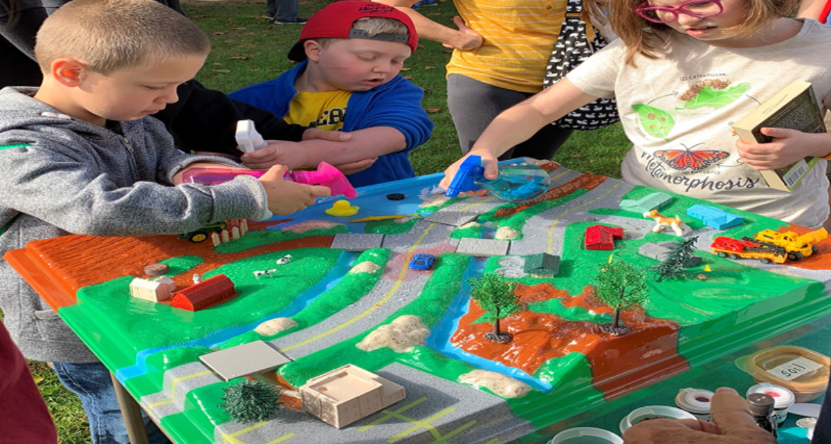
The EnviroScape demonstrates how storm water runoff carries pollutants through the watershed to a pond, lake, river, bay, or ocean, allowing users to simulate rainfall and manipulate the landscape to understand how pollution moves through a watershed.
The Stream Table allows users to manipulate stream flow velocity and stream-side development to understand erosion and deposition, meander development and movement, and sediment transport. In this water-level view, we see a natural environment complete with sticks, beavers, and a meandering channel coexisting with houses, roads, and bridges.
 demonstrates how storm water runoff carries pollutants through the watershed to a pond, lake, river, bay, or ocean, allowing users to simulate rainfall and manipulate the landscape to understand how pollution moves through a watershed.
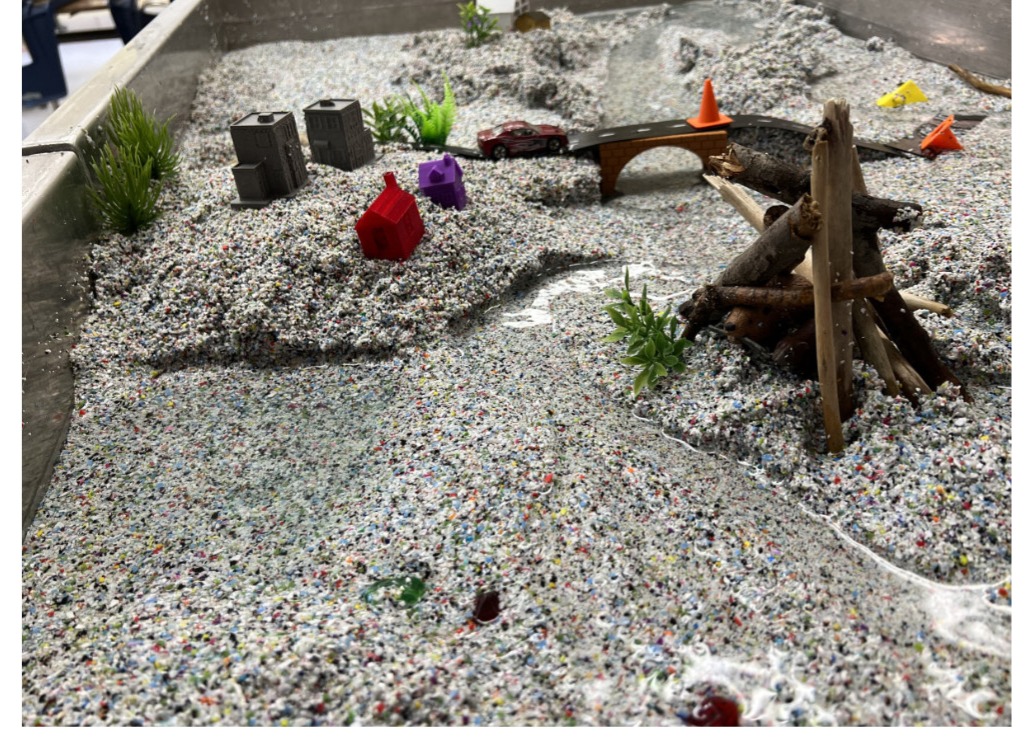 allows users to manipulate stream flow velocity and stream-side development to understand erosion and deposition, meander development and movement, and sediment transport. In this water-level view, we see a natural environment complete with sticks, beavers, and a meandering channel coexisting with houses, roads, and bridges.